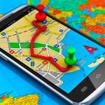
The best map apps for your smartphone
Maps and satellite apps have revolutionized the way we explore and navigate our world. Whether you’re traveling to a new city, exploring a national park, or just trying to find your way around your own neighborhood, these apps can provide a wealth of information at your fingertips.
There are many satellite apps available that allow you to view satellite imagery of your home and other locations around the world. In this post we bring you what we think are the best map apps currently available for both Android and iOS platforms.
We strongly recommend that you have at least one of them installed on your smartphone. They are useful, fun and always free.
Google Earth
This is an incredible app that lets you explore the world from a whole new perspective. With Google Earth, you can view satellite imagery of virtually any location on earth in awesome detail.
Google Earth provides high-resolution satellite imagery. You can zoom in and out, tilt the view, and explore the area in 3D. You can view natural features like mountains, lakes, and rivers, as well as human-made features like buildings, roads, and bridges. Being a powerful and versatile app, Google Earth lets you explore and discover the world in ways you never thought possible.
Google Maps
Another very popular mapping app is Google Maps. With detailed maps of virtually every location on earth, Google Maps is an excellent tool for getting directions and exploring new places. You can search for specific addresses or points of interest, and the app will provide you with turn-by-turn directions to your destination. It also offers real-time traffic information, so you can avoid congestion and get to your destination as quickly as possible.
Waze
In our opinion, one of the best mapping app is Waze. Unlike Google Maps, Waze is primarily focused on providing real-time traffic information. It uses crowdsourced data from other drivers to provide up-to-date information on traffic conditions, accidents, and road closures. It can also help you find the cheapest gas prices in your area.
All Trails
For outdoor enthusiasts, apps like AllTrails can provide detailed maps of hiking and biking trails. AllTrails includes maps, photos, and reviews of thousands of trails around the world. You can search for trails by location, difficulty level, and other factors, and the app will provide you with detailed information about the trail and its features.
Overall, maps and satellite apps are an incredibly useful tool for exploring and navigating our world. Whether you’re traveling to a new city or just exploring your own neighborhood, these apps can provide a wealth of information to help you get where you need to go. With so many great options available, it’s easy to find an app that meets your specific needs and preferences.